


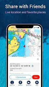


In the world of marine navigation, where accurate charts and real-time information can mean the difference between a pleasant voyage and a dangerous situation, having reliable electronic navigation tools is essential for modern boaters. Welcome to Navionics® Boating, the comprehensive marine navigation app that transforms your mobile device into a sophisticated chartplotter with detailed nautical charts, advanced planning features, and community-sourced data. Unlike basic mapping apps with limited marine information, Navionics provides professional-grade navigation with sonar-chart technology, auto-routing capabilities, and constantly updated charts that include depth contours, marinas, navigation aids, and underwater structures. It's more than just viewing charts; it's a complete boating companion that helps you plan routes considering water depth and boat draft, mark fishing hotspots, track your voyages, and access real-time information from other boaters—all while offering offline functionality for when you venture beyond cellular coverage. Whether you're cruising familiar waters or exploring new destinations, Navionics Boating delivers the accuracy, features, and reliability that today's boaters need for safe and enjoyable time on the water.
What Makes Navionics® Boating a Standout Marine Navigation Tool?
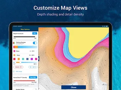
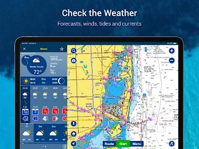
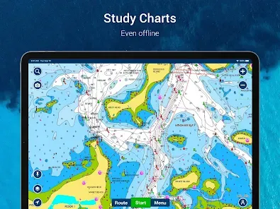
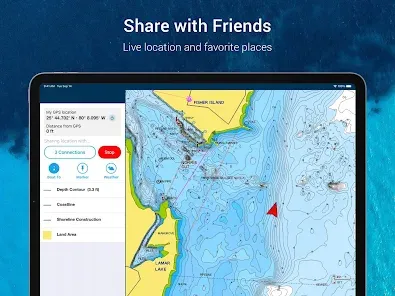
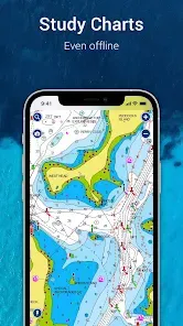
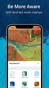
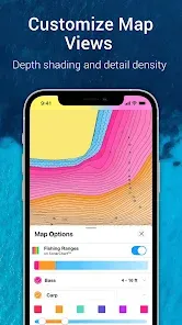
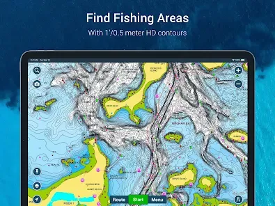
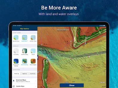
- Detailed Nautical Charts with Sonar Chart™ Technology: Access high-resolution charts with depth contours, navigation aids, marinas, and hazards, enhanced by community-sourced depth data that continuously improves chart accuracy.
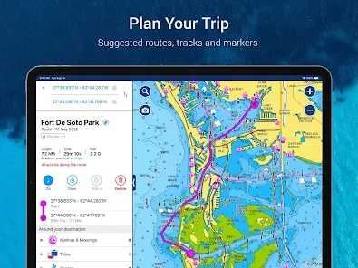
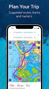
- Advanced Route Planning and Auto-Routing: Create detailed routes with waypoints and tracks, or use the auto-routing feature to generate safe passages based on your vessel's draft and the latest chart information.
- Community Edits and Real-Time Information: Benefit from updates submitted by other boaters including new hazards, marina services, and local knowledge that keeps charts current between official updates.
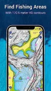
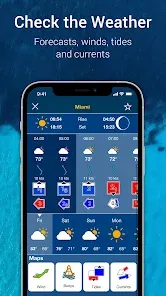
- Comprehensive Fishing and Activity Features: Mark productive fishing spots, view water temperatures, track tides and currents, and utilize detailed information specifically valuable for anglers and watersports enthusiasts.
Who Is Navionics® Boating Ideal For?
- Recreational Boaters and Cruisers: Those who operate powerboats, sailboats, or personal watercraft and need reliable navigation for coastal and inland waters.
- Serious Anglers and Fishing Guides: Fishermen who need detailed bottom contours, the ability to mark productive spots, and information about water conditions.
- Boat Owners and Marine Enthusiasts: Individuals who spend significant time on the water and appreciate having professional navigation tools on their mobile devices.
- Coastal Explorers and Adventurers: People who explore new waterways and need accurate charts and planning tools for unfamiliar areas.
How to Maximize Your Navionics® Boating Experience
- Click "Check All Versions" below to download and install Navionics® Boating on your device or browser.
- Download Charts for Offline Use: Before heading out of cellular range, download the charts for your boating area to ensure access to detailed navigation information.
- Configure Your Vessel Settings: Set your boat's draft, air height, and other parameters to ensure auto-routing and navigation alerts are tailored to your specific vessel.
- Utilize the Planning Features: Create and save routes in advance, including waypoints, notes, and estimated timing for upcoming trips.
- Engage with the Community Features: Contribute your own data and observations to help improve charts for all users while benefiting from information shared by other boaters.

 0
0