ADVERTORIAL
What is Gaia GPS?
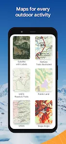
• Overview: Gaia GPS is a GPS navigation app that provides users with a range of maps tailored for outdoor activities, including hiking, mountain biking, and off-roading.
• Purpose: The app aims to help outdoor enthusiasts navigate unfamiliar terrain, plan routes, and enhance their overall outdoor experience.
• Target Audience: Gaia GPS caters to hikers, campers, off-roaders, and anyone who enjoys exploring nature and requires reliable mapping tools.
• Platforms: The app is available on both iOS and Android devices, as well as through a web interface.
Features of Gaia GPS
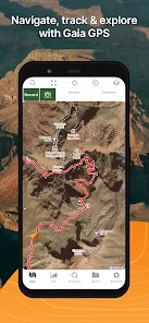
• Detailed Topographic Maps: Gaia GPS offers a variety of high-quality topographic maps, providing detailed elevation information, terrain features, and contours.
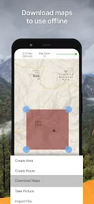
• Offline Maps: Users can download maps for offline use, ensuring access to navigation tools even in remote areas without cell service.
• Route Planning Tools: The app includes tools for creating custom routes, allowing users to plan hikes and trips according to their preferences.
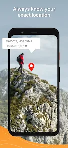
• Waypoints and Tracks: Users can set waypoints and record tracks during their adventures, enabling easy navigation and exploration.
• Weather Updates: Gaia GPS provides real-time weather information, helping users stay informed about changing conditions while outdoors.
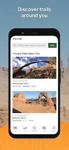
• Community Features: The app allows users to share their adventures and discover popular trails and routes from the Gaia community.
• Sync Across Devices: Users can sync their data across multiple devices, ensuring that all information is easily accessible wherever you are.
Pros and Cons of Gaia GPS
Pros
• Comprehensive Mapping: Gaia GPS offers detailed maps that are beneficial for various outdoor activities, making it suitable for a wide range of users.
• User-Friendly Interface: The app has an intuitive design that makes it easy for users to navigate and access features without a steep learning curve.
• Customizable Routes: The route planning tools allow for flexibility, enabling users to create personalized hiking experiences based on their preferences.
• Offline Capabilities: The ability to download maps for offline use is a significant advantage, ensuring that users can navigate even in remote locations.
• Active Community: The app's community features foster sharing and discovering new trails, enhancing the overall outdoor experience.
Cons
• Subscription Model: While the app offers a free version, many of its advanced features require a paid subscription, which may deter some users.
• Learning Curve for Advanced Features: Although the basic functions are user-friendly, some advanced features may require time to learn and master.
• Battery Drain: Using GPS and maps can consume a significant amount of battery, necessitating power management during extended outings.
• Data Usage: Downloading high-resolution maps and using weather features can consume data, which may be a concern for users with limited plans.
• Limited Global Coverage: While the app excels in the US, some users may find map coverage lacking in more remote international locations.
Functions of Gaia GPS
• Map Navigation: Users can easily navigate using the detailed topographic maps provided within the app.
• Route Creation: The app allows for the creation of custom routes based on user-defined waypoints and trails.
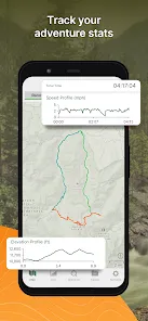
• Track Recording: Users can record their movements while hiking or exploring, providing a digital trail of their adventures.
• Waypoint Marking: Waypoints can be marked for important locations, such as campsites or points of interest, enhancing navigation.
• Weather Monitoring: Users can access real-time weather forecasts and alerts, ensuring that they are prepared for changing conditions.
• Trail Discovery: The app’s community features allow users to discover popular trails and routes shared by other outdoor enthusiasts.
How to Use the Gaia GPS App
1 Download the App: Go to the Apple App Store or Google Play Store to download Gaia GPS on your mobile device.
2 Create an Account: Sign up for a free account to start using the app and access its features.
3 Explore the Interface: Familiarize yourself with the user-friendly layout, which includes map options, route planners, and community features.
4 Choose Your Map Type: Select from various map types, including topographic, satellite, and trail maps, to suit your hiking needs.
5 Download Offline Maps: Before heading out, download the necessary maps for offline access, ensuring you have navigation tools even in remote areas.
6 Plan Your Route: Use the route planning tools to create your hiking itinerary, setting waypoints for points of interest along the way.
7 Start Your Adventure: During your hike, use the app for navigation, following your planned route and marking waypoints as needed.
8 Record Your Track: Enable the track recording feature to capture your movements and create a trail map of your adventure.
9 Check Weather Updates: Regularly check the weather feature for updates on conditions during your hike, allowing you to adjust your plans accordingly.
10 Engage with the Community: Share your adventures and discover new trails by participating in the Gaia GPS community features.





 0
0